After returning to Hilo from the jungles of Puna, we set about making Libertatia again fit for the open ocean. We had a handful of projects we needed to complete before setting sail, a lot of organization and stowage to do and a whole list of other things that we would like to get done. Many of these non-critical projects fell by the wayside but by the end, we had things looking pretty ship-shape and, after a seemingly endless string of dinghy trips to shore, we had mostly-full fuel and water tanks. Luckily, our time spent working on the boat was punctuated by farewell visits from many of the friends that we had met during our time in Hilo and we made sure to make time for one last hurrah on the Sunday night before we departed, backing up our friend Ydine at a “goddess-themed” music show just outside of Hilo. Of course a late night, a few last-minute tasks, and a drumset to break down made for a late departure the next day, but we hoisted sails and were outside the breakwall by one o’clock.
 |
| Lowell and Vincent enjoy our final days in Hilo Bay, watching the sunset over Mauna Kea. |
As we had experienced on our initial approach to Hilo, the sailing in the waters off Hilo bay and along the northeast shore of the big island can be quite frustrating: again we found ourselves in light wind, bouncy seas and a fair current pushing us to the southeast. It became overcast late in the day and showered periodically throughout the night as we flopped around, making headway into the NNW winds and then losing it to the current. With all sails up we tacked further and further to the northeast in order to avoid the strongest flow close to shore and by morning we found ourselves well north but slightly east of Hilo. We stuck with it for a while, despite the discomfort of the large chop, and as we entertained thoughts of firing up the engine, the wind picked up and we began to make some headway. Throughout the day, the wind remained steady and continued to blow between 5 and 15 kt. Jenine manned the helm for most of the day and quickly proved herself an excellent skipper, after initially taking a few hours to allow her childhood sailing experience to bubble up from the depths of her memory. Lowell and I generally split the night watch and although Jenine ended up do much of the driving during the day, cameo appearances were made by Damon, Wai’ele and Naomi.
The overcast skies and light winds made for a few days of sailing that seemed to blur together. As we headed up the coast of the big island, the wind clocked slowly around to the north and then to the northeast and we were able to point above Maui, back to our planned course. We continued along, passing some distance north of Maui and Molokai, giving ourselves plenty of sea room. Unfortunately, this meant that we missed seeing the beauty of the windward shores up close and next time I think we will try to get a bit closer.
The impetus for the trip, and especially our quick departure, was that Jenine’s and my mother, Nancy, was on Kauai for a conference. Between leaving the farm in Puna and Nancy’s departure from Hawaii, we had a relatively short window in which to hang out with her on Kauai. Our languid first day of sailing put our original ETA into question but we were still looking good as we passed Molokai. As we listened to the weather we learned that a low-pressure system was approaching the islands from the southwest and was whipping things up a bit, especially in the Kauai channel. We decided to pass through the channel, between Molokai and Oahu, in order to be close to shelter should we need to run in but also to be in a good position to reach across on the forecasted southerlies, should we decided that we could make it to Kauai. We passed through the channel at night and again found ourselves flopping about as the wind died. We awoke to see Diamond Head in the distance to the west and we fired up the engine for a spell before the wind built from the southeast as the low approached us. We cut across the Penguin Bank at the southwesternmost tip of Molokai and headed for Lono Harbor (Hale o Lono) in the company of many Humpback whales. We entered the harbor in the mid-afternoon, dropped the hook and Tahiti-moored to a cleat on an old wall on the north side of the Harbor. We were greeted by Ula, the dog, who jumped off the wall and swam over say hello as we all took a moment to enjoy the peace and stillness of the harbor.
 |
| Damon on the bow, the evening of our arrival to Hale o Lono |
Lono Harbor, we were told during our stay, was originally built as a port for ships and barges carrying sand from Molokai to create the beautiful white sand beaches of Oahu. Sand was harvest on the west coast of Molokai, trucked over land and then dumped off the cliffs above the harbor, from where it was shuttled on to the barges. The east breakwater also served as a small airstrip and dolphins (small pier-like structures with bollards) surround the harbor for securing ships and barges. The name comes from a demi-god, Lono (hale is the Hawaiian word for home), who inhabited a cave at the base of the cliffs above the harbor. Our friend Chuck, sole resident and caretaker of the harbor, thought that the cave must be buried behind the residual pile of sand.
 |
| Chuck's water condo and sloop tucked into the east end of Lono Harbor |
We ended up spending a week in Lono. During the first few days, rain kept us inside the boat and brought an extraordinary amount of moisture to the arid landscape. We did some work on the electrical system, installed our chartplotter (generously gifted to us), and did a fair amount of reorganization. When the sun came out a few days later, we moved outside and did a handful of projects. After some underwater inspection we discovered that the chainplate for the boomkin bobstay was quite loose. With some wiggling and release of tension on the turnbuckle, it just fell out. After some scrutiny, we decided that the lag bolts used to fasten the chainplate were undersized and too old (the threads were somewhat worn). In order to fix the issue while in the water, we didn’t have much of a choice but to refasten the chainplates with larger lags and readdress the issue we next haul out.
 |
| Lowell tears into the electrical system |
The most interesting operation, however, was tipping the boat in order to touch up the bottom paint just below the waterline on the starboard side. We did it by tying two lines to the port rail, running them under the boat, and attaching them to a dolphin on the south side of the harbor (the bow was pointing east). Then we ran two lines from separate dolphins on the north side of the harbor through temporary blocks affixed at the spreaders on both masts and down to the winches at the base of each mast. We slowly tipped her over, winching alternately on the main and mizzen mast lines, until we had just over a foot below the waterline exposed amidships. We also took advantage of the opportunity to touch up the topside paint, which had also suffered damage due to having the dinghies tied alongside at our bouncy anchorage in Hilo. We were also able to do a bit of exploration around and walked several times to the town of Maunaloa, five miles away. Much of the western side of Molokai is owned by a New Zealand-based company under the name Molokai Ranch. We were told that the company had tried to build a high-end development on the southwest tip of the island but that the people of Molokai had effectively prevented it. In response, the company closed the ranch, putting over one hundred people out of work, turning Maunaloa into somewhat of a ghost town, and denying access to all lands owned by the ranch. (Note: Unfortunately we've had technical difficulties with my camera and don't have many pictures of our time in March)
 |
| Jenine and Wai'ele enjoy the Hale o Lono sunset |
The land around Lono Harbor is obviously very dry but we were able to be there at a relatively verdant time. The landscape is dominated by kiawe (mesquite) trees originally brought to the island as bee fodder by apiaries. Although beautiful and extremely well-suited to the climate, the thorns of the kiawe make for painful travel with bare feet or even with sandals. Beneath the kiawe trees were mostly grasses, lush and green at the time of our visit but no doubt browning quickly after the departure of the spring rains. Our walks to Maunaloa took us up the dry hillside and into wetter areas as we rose in elevation. Just as we reached town, we would come over a crest that seemed to be something of a division between windward and leeward side and would find a wetter climate with different trees species and taller grass. On the road, we would also go through areas rich in red clay, clearly showing the age of the island as compared to the fresh black rock and coral sand beached of the big island. The coastline in the area is made of narrow and extremely beautiful white sand beaches, behind a reef stretching along the entire shore and divided occasionally by rocky outcroppings. At almost any time, humpbacks were visible spouting, breaching, or with tail in air, enjoying the relative calm in the lee of the island.

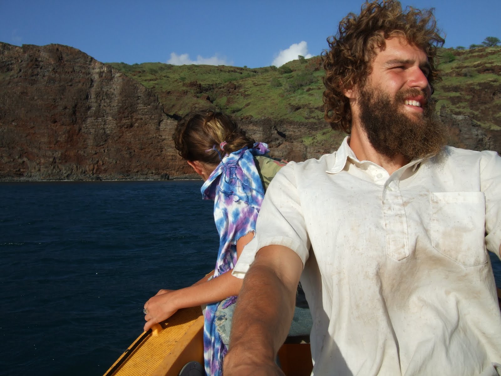
After bidding farewell to Chuck and Ula aboard their “water condo” (a retired scuba catamaran without a mast), we departed for Kaunakakai, the main port on Molokai. We made our way out into the Kalohi channel (“rascal” in Hawaiian), and beat upwind in 20-25 kt and 4-6 ft seas. This was the hardest we had sailed the boat upwind at the time and although she doesn’t point too well, she does just fine to weather. Again in the company of whales, we dipped in and out of the lee of the towering eastern side of Molokai and eventually arrived in Kaunakakai as night fell. We dropped anchor in the glow of the lights on the pier next to another Ed Monk boat, “Doubloon,” and met her owner, Stretch, on shore shortly thereafter. We took a late walk into town to find the fabled Molokai bread company, which serves bread from an alley doorway beginning at 9:00 PM. We were successful in our mission and promptly devoured a cinnamon/cream cheese loaf, leaving us in extreme need of a good tooth brushing. We had considered departing Kaunakakai the next day but instead decided to spend the day resting and doing errands in town. The town itself was not too large and had an end-of-the-world, frontier feel, pushed up against the ocean against a backdrop of steep, vast green hills carved by rocky canyons and disappearing into thick clouds swirling around from the windward side. We were able to explore one canyon just above town and standing on its rim, looking up the slopes and down at the harbor below, we could better see and feel the wild vastness of the island. That evening, we were able to fill our water tanks on the pier before the arrival of the foot-ferry from Maui and we re-anchored, planning to make an early start in the morning. We were enjoying a relaxing evening until we received a call from Vincent reporting the earthquake in Japan. We knew that we had many hours before the arrival of a wave so we began slowly getting things together as the forklifts and trucks drove off the pier for higher ground. The warnings sirens began to sound around nine or ten and the pier became quite busy as people came to pull boats out of the water. We even received a visit from a woman that we met earlier in the day, who came down to check on us. Luckily, we were nearly ready to take off and we had time to take it easy before pulling up the dinghies and leaving around midnight. Although our original thought was to head further east along the coast of Molokai before jumping over to Maui, we decided that heading to Lanai would also be fun and would put us in deeper water, in addition to making for an easier night of sailing.
 |
| The west coast of Lanai |
We headed off on a broad reach and were several miles off the west coast of Lanai when the tsunami arrived. Much to our disappointment, we didn’t feel a thing. The next morning we continued south slowly along the Lanai coast before looking at our chart and deciding to double back a bit in order to anchor off the pinnacles at Nanahoa, right in the armpit of the west side. We spent four days there and our adventures were many: swimming with dolphins, exploring the hillsides, exploring the shorelines, and trekking into the town of Lanai City.
 |
| Lowell at home in the canyons of Lanai |
The coastline along the west coast of Lanai was incredible, mostly dominated by sea cliffs hundreds of feet above the rocks below. Being the leeward side of the island, the climate was again quite dry and the hills were covered with grasses, kiawe, and exposed rock and home to deer, sheep, and goats. The slopes were carved by a great many small valleys or canyons, most of which terminated atop the cliffs and would send water vaulting out into the ocean when water was moving over the landscape.
 |
| Our anchorage off the Pinnacles |
Some canyons did make it down to the shore and left huge fins and narrow ridges between them and the ocean. Being in the canyons themselves was reminiscent of wandering through the dry creek beds and deep valleys of the southwest, complete with red muddy soil on the canyon floor.
 |
| The Lanai coastline |
We had heard of deep clear water where you could watch your anchor drop all the way to the bottom and we found it off Lanai. At one point I was replacing corroded nuts on the rudder shaft and jumping in with wrenches in hand, I lost my snorkel mask off my face. I was able to hop out of the water onto the boat, put on goggles and jump back in only to watch the mask drift slowly to the bottom. It hit bottom about sixty feet below, very small but clearly visible. I rigged up a two-hook salmon fishing leader to the end of our lead line and after about 30 minutes of floating at the surface, dropping the lead as close as I could, and trying to drag the fish hooks over the mask I hooked the strap and brought it back up to the surface. Amazing.
We left Lanai bound for Lahaina, Maui with hopes to meet up with friends from Hilo who were on a short trip to the other islands. We headed south along the coastline of shear cliffs with a nice breeze behind us. The wind quickly died as we turned to head east, however, and we inched along under the enormous rock faces. Here we saw a few seabirds that seemed to be nesting on or at least hanging out near the cliffs, a sight that we have found to be quite rare in the islands. Especially compared to back home on the Puget Sound with its gulls, terns, ducks, geese, cormorants, alcids, and others, Hawaii seems to be mostly devoid of birds on the water.
 |
| Tsunami survivors Jenine and Emmett |
We flopped around and motor-sailed for a while until we were in the channel between Lanai and Maui, with the grand mountains and valleys of west Maui hills approaching steadily. Looking at a chart or a satellite image of the islands, it is clear that the ocean bottom between Molokai, Lanai and Maui is not too deep, especially compared to the channels between the other islands and surrounding ocean. It seems that this, combined with the relative calm in the lee of Maui, creates an ideal hang-out zone for whales and we were surrounded by humpbacks as we came closer to Lahaina. We ended up anchoring just north of town in Mala Bay, at the northern end of the mooring field. There we were excited to find boat people, cruisers and liveaboards alike. We met some very nice folks from Alaska aboard a true home-made Alaskan sloop: steel with a stainless companionway hatch that looked like a vault door and pressure treated cockpit combings. Although it was initially fun to wander the tourist-packed streets of the town, the glamour quickly wore off and were left feeling so-so about Lahaina. We did have some great fun there, however, visiting with our lovely friends from Hilo, busking on the street, raiding coconut palms, and working on the boat. We even had a chance to get out of town and take the bus over to Paia to visit family of Wai’ele’s. This little excursion gave us a taste of the Maui that we would probably enjoy more than Lahaina and as we get closer to summertime and the north swell dies down, hopefully we will get a chance to cruise by the north sides of the islands and explore a bit more.
 |
| Approaching the Maui, just south of Lahaina |
We left Lahaina for the southern tip of Maui, in preparation to jump off for the big island. Just south of town, we encountered some of the most variable winds I have ever seen: steady 15 kt winds dying and shifting and then coming from the opposite direction. It seemed apparent that this area was the meeting place of the air coming around the north side of the island and the air coming over the isthmus and circling up under the western lobe of Maui. Sure enough, the wind steadied as we headed southwest and we made our way around the corner. As we came around, still in the lee of the mountains we could see the windmills spinning up on the hills and we were suddenly caught with too much sail up as the wind came over the eastern edge of the hills and pounded the water below. We were quickly hit by a few gusts of 30-35 kt and we had water through the ports in the cabin house as we heeled and rolled in the chop. We were able to drop sails, down to a reefed mizzen and forward stays’l, and continue on our way. The wind, although quite strong, came as the result of strong trades funneling over the middle of Maui. We sailed on and were able to drop anchor as dark fell, just north of Makena beach in windless but quite choppy conditions.
 |
| The galley, complete with artwork by our friend Kiyana |
Early the next morning, we were able to go for a swim and inspect the anchor which didn’t seemed to be in the best holding. We picked up the anchor, and after motoring a bit north and a bit south, decided that where we were before might be the best spot we could find. Anchoring again in the daylight, we found a better spot and spent the next couple days, readying the boat for the Alenuihaha. Mostly we were just making sure everything was battened down, but after we were finished organizing, the boat looked more ship-shape than ever.
We decided to make our crossing at night, with the hope that the breeze would be a little bit lighter and we picked a night where the forecasted winds were five knots lighter than the forecasted 30 knots for the rest of the week. After finishing our preparations in the mid-afternoon, we took some time to relax and check out the weekly Sunday beach party and drum circle at Little Beach (the nude beach just north of the main Makena beach park). This was, as expected, fun and weird and we left after a few hours to take off for Kona. We had an exciting, bouncy dinghy ride out to the boat and after a quick bite to eat and were headed out in the dark. We could hear the drums as we cruised past Little Beach and soon Maui disappeared into the dark.
We were definitely apprehensive as we approached the Alenuihaha, the channel between Maui and the big island. This channel has the reputation as being one of the more difficult stretches of water to cross in the world as the wind and current are funneled between the 3055 m Haleakala on Maui and the 4205 m Mauna Kea on the big island, while the ocean floor lifts from thousands of fathoms of depths to hundreds. The wind built slowly as we headed south and the near-full moon rose over the hills. Soon enough we were out in it, wind blowing 25 kt over 10-15 ft swells, dark and silver in the moonlight. We were prepared this time for a rise in the wind and reduced to reefed mizzen and forward stayls’l before we were overpowered.
The night was long and raucous, but far from unmanageable. The moon lit the way and the raw beauty of the ocean was intense as we rolled along and pounded into the oncoming waves. We were headed south when we entered the channel and concerned about making too much leeway towards Kaho’olawe but soon enough the wind started coming more from the north and we headed up towards the big island. We were still trying to point quite high to reach Kona but were moving very slowly (about three knots) and being set south by the current. The short period of the relatively large waves was preventing us from getting up boat speed but we trucked along and before too long the sun was rising over Mauna Kea. The wind held up for a while in the morning, died, and then built again before completely dying in the late morning. We were forced to fire up the engine and power the last 25 miles or so in the glassy calm, yet remarkable swelly waters to the northwest of Kailua- Kona.
The rest of our passage was without too much excitement. We all found some time to have a snooze and relax as we made our way south against the majestic backdrop of the west coast of Hawaii island, first the Kohala Mountains and then the dry, barren expanse of the Kona coast. On our way we discovered someone’s secret fish aggregation device (FAD), a wad of line, net, and other flotsam anchored to the ocean floor. The state has created many FADs around the state to provide micro-habitats and thus open-ocean hotspots for fishing. Sure enough, the water around the pile of junk was teeming with small fish and we saw several Mahi Mahi jumping as we cruised past.
We entered Kailua Bay under full sail (and a little bit of diesel power) as the sun was going down, tied up to the mooring (generously lent to us by our friend Melinda), and threw on the sail covers before piling into the dinghy and heading in to find Steve and Vincent waiting for us on the pier.
 |
| Moored off Kailua-Kona |